Precision Agriculture: How Data, Technology, and Farmers’ Expertise Are Transforming Modern Agricultural Production
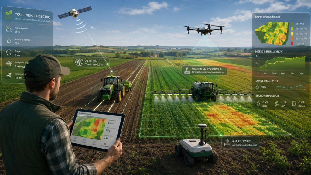
Agriculture can no longer be viewed solely as work with machinery, soil, and crops. Increasingly, agribusiness is moving into the realm of precise decisions, digital tools, automation, and advanced analytics. A field is no longer just an area measured in hectares — it becomes a source of data that helps identify its potential, weak points, the economic feasibility of each operation, and the real impact of technology on the final result.
This is the essence of precision agriculture. In its classical sense, it is an innovative farming method that involves the use of modern technologies to improve crop quality. However, in practical terms, precision agriculture is much broader. It combines human experience and expertise with modern technologies to ensure that the right amount of resources is directed to the right areas of production — ultimately generating financial benefit.
In other words, precision agriculture is not just equipment installed on a tractor, not merely GPS navigation, and not a standalone mapping program. It is a comprehensive agricultural management system in which decisions are made not intuitively, but based on verified data. A farmer can see what is happening in the field, understand which zones have higher potential, where costs do not pay off, which operations have been performed properly, and where deviations have occurred. As a result, the farmer can work not simply harder, but smarter.
Why Precision Agriculture Has Become a Necessity
In an environment of intense competition, rising resource costs, unstable weather conditions, and the constant need to improve efficiency, agricultural production faces new challenges. Fertilizers, seeds, fuel, crop protection products, technical maintenance, and the working time of the team all have a cost. That is why the key question today is not only “How can we get a higher yield?” but, more precisely, “How can we achieve an economically justified result from every hectare?”
A field is almost never uniform. Even within a single land parcel, there may be different soil types, variations in moisture, compaction, relief, nutrient content, cultivation history, and yield potential. If such a field is managed uniformly across the entire area, some resources will inevitably be used inefficiently. Some zones may receive less nutrition than they need, while others may receive more than they can actually convert into yield. As a result, the farm loses money, time, and part of its potential profit.
Precision agriculture helps move away from the “one rate for the entire field” approach and toward managing each zone according to its actual condition and potential. This makes it possible to optimize costs, improve the quality of operations, reduce the human factor, better control machinery and personnel, and build a long-term decision-making system.
Data as the Foundation of Precision Agriculture
The key principle of precision agriculture is that you can only manage what you can measure. That is why any implementation begins with data. Data may come from various sources: machinery, GNSS systems, RTK networks, sensors, weather stations, satellite monitoring, drones, agrochemical soil testing, yield mapping, scouting, and field observations.
However, data alone has no value unless it is structured, analyzed, and transformed into specific management decisions. Precision agriculture works when a farm has established a complete cycle: data collection, storage, analysis, operational planning, field execution, quality control, and further improvement of the technology.
For example, agrochemical soil testing shows which nutrients are available in the soil. Soil compaction monitoring helps determine where the root system may face physical limitations. Yield mapping shows the actual field result after harvesting. Satellite and drone monitoring make it possible to assess crop condition throughout the season. Weather monitoring helps choose the optimal time for operations. Telematics allows machinery performance to be monitored in real time.
When these data streams are combined, the farmer receives not isolated fragments of information, but a complete picture of the field and production processes.
Key Elements of Precision Agriculture
Precision agriculture consists of many elements that gradually form an integrated management system. These elements can be viewed as successive levels of development — from basic technologies to full management of field zones.
The first level is the basic level. It includes the creation of digital field boundaries, connection to an RTK network, parallel guidance, and the use of software for data storage and analysis. At this stage, the farm receives a foundation: precise field boundaries, stable navigation, clear machinery routes, and the first digital data for analysis.
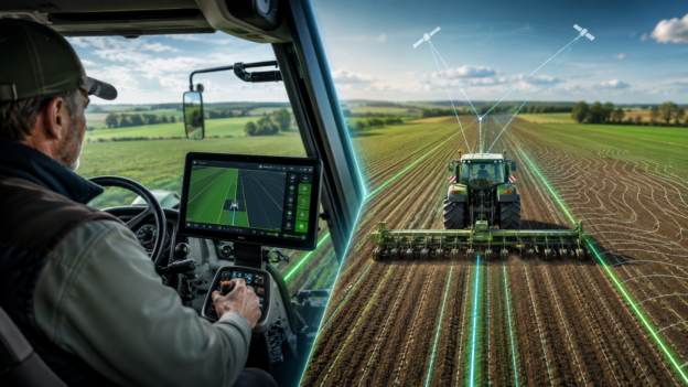
Parallel guidance is one of the most common starting tools. It helps reduce overlaps and skips during field operations, saving fuel, working time, and inputs. Combined with an RTK signal, the farmer gains high-accuracy positioning, which is essential for repeatable operations, controlled traffic lanes, variable-rate application, and automated machinery control.
The second level is the mandatory level. It includes planter section shutoff, automatic sprayer rate control systems, and controlled traffic lanes. These solutions directly affect the quality of field operations. Section shutoff helps avoid double seeding in overlap areas, automatic rate control maintains application accuracy, and controlled traffic lanes help organize machinery movement across the field while reducing unnecessary soil compaction.
The third level is the technological level. It includes agrochemical field testing, soil compaction monitoring, and assessment of operation quality. At this stage, the farm no longer merely automates machinery — it begins to understand the field more deeply. Soil analysis shows which resources specific zones require. Compaction monitoring helps identify physical limitations affecting plant development. Quality assessment verifies whether the technology has actually been implemented as planned.
The fourth level is precision agriculture in its practical sense. This is where yield mapping, prescription maps for variable-rate operations, and variable-rate fertilizer application come into play. This is one of the key stages, as the farm moves from data collection to practical use. Yield maps show how the field realized its potential in a particular season. Prescription maps convert analytics into a specific instruction for machinery. Variable-rate application allows fertilizers to be distributed not uniformly across the whole field, but according to the needs of each zone.
The fifth level is agronomic monitoring. It includes weather monitoring, satellite monitoring, drone monitoring, and scouting. At this stage, the farmer gains tools for operational control of crop condition and field conditions. Weather data supports decisions on spraying, fertilization, and other technological operations. Satellites and drones help detect uneven crop development, stress zones, moisture-related issues, and nutrient problems. Scouting complements digital data with in-field verification and agronomic analysis.
The sixth level is the advanced level. It includes precise application of crop protection products, farm management systems, dispatching, ERP systems, and technological operation management systems. At this stage, precision agriculture extends beyond an individual field and becomes part of the management of the entire farm. The manager, agronomist, engineer, and machine operator work within a unified information system where tasks, machinery, completed operations, input consumption, and results are visible.
The seventh level is zone management. This is the highest level of system maturity, where the farm identifies homogeneous field zones, determines the potential of each zone, assesses the economic feasibility of technologies, and applies variable-rate seeding. At this stage, decisions are made with maximum precision: not simply “what should be done in the field,” but “what should be done in a specific zone, why exactly this approach is needed, and what economic result it should deliver.”
RTK, GNSS, and Digital Field Boundaries
One of the fundamental elements of precision agriculture is accurate positioning. GNSS systems make it possible to determine the location of machinery, its speed, and direction of movement. An RTK network increases the accuracy of navigation equipment and enables highly repeatable field operations.
Digital field boundaries are another basic element. They create an accurate digital model of field limits, which is then used by navigation systems, software, prescription maps, and analytical tools. Without correct boundaries, it is difficult to plan operations properly, assess areas, generate tasks for machinery, and analyze results.
In precision agriculture practice, RTK, GNSS, and digital field boundaries form the foundation on which further automation is built. Without them, variable-rate application, controlled traffic lanes, autosteering, mapping, and high-quality analysis of field operations cannot work effectively.
Automated Steering Systems: Accuracy That Works in the Field
Automated machinery control systems — autosteering systems — hold a special place in the structure of precision agriculture. An autosteering system is a tool that directly affects the quality of field operations. It helps machinery move along predefined lines with high accuracy, reduces overlaps and skips, maintains pass-to-pass consistency, and saves fuel, working time, seeds, fertilizers, and crop protection products.
Combined with RTK navigation, autosteering systems become the basis for repeatable technological operations. This is important not only for operator comfort, but also for creating controlled traffic lanes, accurate seeding, high-quality fertilizer application, spraying, and further analysis of completed operations. When machinery moves accurately, every subsequent operation becomes more controlled, and the entire production system becomes more predictable.
Yield Mapping: When the Field Speaks the Language of Results
Yield mapping is one of the most important tools for understanding the real productivity of a field. The average yield figure may look acceptable, but it does not show what is happening inside the field. Some zones may generate a high yield, while others may operate on the edge of profitability. Without a yield map, these differences remain hidden.
A yield map allows farmers to see where the field generates profit, where resources are used efficiently, and where the production technology needs to be reconsidered. Combined with agrochemical analysis, data on compaction, relief, moisture, and operation history, it becomes the basis for identifying productivity zones and creating prescription maps.
It is not just an attractive image after harvest. It is a management tool that helps adjust the approach for the next season: refine fertilizer rates, change seeding density, assess the payback of technologies, and better understand the field’s economics.
Variable-Rate Application and Variable-Rate Seeding
One of the key tasks of precision agriculture is to direct resources to where they are truly needed. This is precisely why variable-rate fertilizer application, precise application of crop protection products, and variable-rate seeding are used.
Variable-rate fertilizer application is based on data about soil, zone potential, and crop needs. Instead of applying a uniform rate across the entire field, the system allows the rate to change depending on the specific zone. In zones with higher potential, productivity can be supported, while in lower-response zones, unjustified expenses can be avoided.
Variable-rate seeding works on a similar principle. If a certain field zone can provide better conditions for plants, it may receive a different seeding density. If a zone has limitations, the technology adapts to its real potential. This approach makes it possible not simply to increase rates, but to manage them from the standpoint of agronomic and economic feasibility.
Weather Monitoring and Field Operation Control
Weather conditions directly affect the quality of field operations. Temperature, humidity, wind direction, and wind speed may determine whether spraying should be carried out, whether there is a risk of spray drift, and whether the time is suitable for application, seeding, or other operations.
That is why weather monitoring is an important part of precision agriculture. Data collected directly from the field is especially valuable — not only information from remote weather stations. When the farmer sees the microclimate in the zone where machinery is operating, decisions can be made faster and more accurately.
Field operation control is equally important. Modern digital controllers can track speed, fuel consumption, rate deviations, downtime, application quality, and other parameters. This reduces the human factor and gives the manager or agronomist the ability to see the real field situation from a smartphone or computer.
Ultra-High-Precision Sprayers: A New Level of Crop Protection Application
One of the most promising areas in the development of precision agriculture today is ultra-high-precision spraying. Unlike traditional systems that operate with boom sections or individual nozzles, these solutions can recognize individual plants in real time and apply the product only where it is truly needed.
A strong example of this technology is the ARA system by the Swiss company Ecorobotix. It uses high-resolution cameras, computer vision algorithms, and artificial intelligence to identify crops and weeds directly while the implement is moving. After recognition, the system instantly activates the relevant nozzles and performs localized application with plant-level precision.
This approach significantly reduces the use of crop protection products because the entire field is not treated — only specific targets are. In many cases, savings on products can reach dozens of percent, and sometimes even more, depending on the crop, weed type, and production technology. At the same time, the chemical load on the soil and the environment is reduced, making production more sustainable and environmentally responsible.
This technology combines automation, machine vision, data analysis, and precise application into a single system in which every drop of product has a specific target. It demonstrates what the future of crop protection can look like: maximally precise, economically justified, and managed at the level of an individual plant.
FlyAgData as an Example of an Ecosystem Approach
One example of a modern approach to field operation management is FlyAgData — a development by the FRENDT R&D Center. This solution was created to help farmers control field operations and microclimate without complex integrations or excessive dependence on external services.
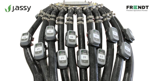
The system consists of a digital controller and a mobile weather station. The controller can be installed on a tractor, sprayer, planter, cultivator, or spreader and records key operating parameters in real time. The mobile weather station collects data on air and soil temperature, humidity, wind direction, and wind speed. Together, these elements create an ecosystem in which decisions are made not on assumptions, but on accurate data.
This approach is especially important for farms that want to make production more transparent. When the history of completed operations is stored, it can be analyzed, compared, used to identify deviations, and applied to improve the technology from season to season.
Precision Agriculture Is Also About People
Despite the development of automation, precision agriculture does not replace people. On the contrary, it strengthens the role of the specialist. Technologies collect data, but it is people who determine how to interpret it, which decisions to make, which risks to consider, and how to combine digital information with real field experience.
That is why personnel training is an important element of precision agriculture. GNSS systems, RTK navigation, software, prescription maps, automated control systems, telematics, and analytics all require competent use. Machinery may be modern, but without a trained team, its potential will not be fully realized.
Precision agriculture is therefore not only a technological culture, but also a management culture. It requires discipline, responsibility, data-driven work, continuous process improvement, and readiness to change familiar approaches.
The Economic Logic of Precision Agriculture
The main goal of precision agriculture is not to install as much equipment as possible, but to generate measurable value for the farm. Every technology must answer specific questions: What problem does it solve? What costs does it reduce? Which process does it improve? How does it affect yield, quality, resources, or management?
That is why identifying the potential of zones and the economic feasibility of technologies is so important. Not every part of a field requires the same level of investment. Not every solution has the same payback across different farms. Precision agriculture helps identify where a technology truly creates value and where it needs to be adapted.
How a Farm Can Start Implementing Precision Agriculture
Implementing precision agriculture does not necessarily have to begin with the most complex technologies. The best path is to move gradually — from basic tools to deeper analytics and automation.
First, it is worth establishing accurate digital field boundaries, navigation, RTK connectivity, and parallel guidance. Next, farms can implement section shutoff systems, automatic sprayer rate control, and controlled traffic management. After that, the next steps are agrochemical testing, soil compaction monitoring, operation quality assessment, and yield mapping.
The following stage involves working with prescription maps, variable-rate application, weather monitoring, satellite monitoring, scouting, and farm management systems. Once a sufficient data base has been formed, the farm can move toward zone management, variable-rate seeding, and a deeper economic assessment of each field zone.
This approach helps avoid chaotic investments. The farm does not simply purchase separate technologies — it builds a system in which each next element strengthens the previous one.
The Future of Agribusiness Lies in Precision
Precision agriculture is a path toward a new level of agricultural production. It changes the logic of working with fields, machinery, resources, and people: instead of intuitive decisions — analytics; instead of a uniform approach to the entire field — zone management; instead of manual control — digital systems; instead of reacting to problems after losses occur — timely detection of deviations and technological correction.
That is why the future of agribusiness belongs to those who can do more than simply work in the field — those who can see it more deeply through data, technology, analytics, and experience.