Field Boundary Surveying and Navigation Lines: The Foundation of Precision Agriculture by FRENDT
In modern agricultural production, precision has ceased to be a competitive advantage – it has become a condition for survival. Ten to fifteen years ago, a farm could operate “by experience,” relying on average application rates and a general perception of the field. Today, such a model generates systemic losses. Fuel costs are rising, seeds and fertilizers are becoming more expensive, and crop protection products are increasingly technological and, accordingly, more costly. Weather risks are intensifying, while the available workforce in agriculture is declining. In this reality, every hectare must be under control, and every operation must be predictable.
A farm can no longer afford to work approximately. It needs a system. It needs structure. It needs precise field geometry.
Within this system, the first step is not the purchase of new machinery, nor even the installation of an autosteer system. The first step is the proper surveying of field boundaries and the professional formation of navigation lines. Without this foundation, even the most advanced technology operates on inaccurate data.
This is precisely where the digital transformation of the field begins in the practice of FRENDT – Precision Agriculture Provider.
Geometry as an Economic Category
Most farms operate using field boundaries created years earlier. Often these are data from free mapping services or borders recorded during the initial setup of a navigation display. On the screen, machinery moves smoothly, overlaps appear minimized, and the operator is satisfied. However, the system is working with conditional geometry rather than the actual field area.
The discrepancy between the actual and the “digital” field area sometimes reaches 1–3%, and on complex fields with irregular borders, it may be even higher. This difference is automatically embedded in fuel consumption, seed rates, fertilizers, and crop protection products. It affects the creation of prescription maps, agro-analytics, cost calculations, and financial planning. Field geometry becomes an economic category.
For this reason, professional boundary surveying is not a minor technical detail but a managerial decision.
How Boundary Surveying Is Performed in FRENDT’s Practice
FRENDT specialists conduct surveying using high-precision GNSS/RTK navigation, ensuring centimeter-level accuracy. An engineer travels directly to the field and records the actual boundaries of the land parcel, taking into account all features – shelterbelts, ravines, power lines, waterlogged areas, and technological roads. The field is documented as it exists in reality, not as it appears on a satellite map.

Following the fieldwork, the data are processed and structured into a digital database that can be integrated with autosteer systems, RTK correction signals, agro-analytics platforms, and management accounting systems. The farm receives not merely a file for a navigator, but a full-fledged digital asset that serves as the basis for subsequent technological decisions.
Why Boundaries Are the Basis of All Subsequent Processes
Without an accurate boundary, it is impossible to create a high-quality variable-rate application map. It is impossible to properly analyze yield data. It is impossible to accurately assess operational performance. Any initial inaccuracy multiplies at every subsequent stage.
When a farm implements autosteer systems, such as TerraNavix, or transitions to RTK correction, expectations are linked to cost savings and operational stability. However, even the most advanced automatic steering system cannot compensate for errors in baseline data. If the boundary is built inaccurately, the machinery’s movement algorithm will operate within the limits of that inaccuracy.
Precision does not begin with the antenna on the cab roof, but with the geometry of the field.
Navigation Lines as a Movement Strategy
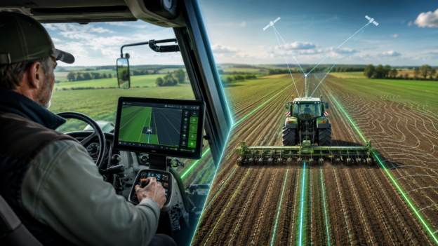
After establishing an accurate boundary, the next stage is the construction of navigation lines. These lines determine the logic of machinery movement across the field. In many farms, navigation lines are created by the operator without in-depth analysis. A base line is selected, parallel guidance is generated, and the process ends there.

Within FRENDT’s systematic approach, navigation lines are formed with consideration of topography, field configuration, implement width, cultivation technology, and soil compaction minimization. For complex field shapes, curved or contour guidance schemes are applied to reduce non-productive passes and minimize the number of headland turns. As a result, fuel consumption decreases, working time is reduced, and application quality becomes more stable.
A properly designed line is an algorithm. And the algorithm determines the efficiency of every pass.
Impact on Farm Economics
According to practical observations, properly conducted boundary surveying and professionally designed navigation lines can reduce overlaps by 3–7%. The number of unnecessary passes decreases, machinery logistics are optimized, and operational time is shortened. For a farm managing several thousand hectares, this translates into tens of thousands of hryvnias in savings already in the first season.
However, the economic effect is not limited to direct cost reduction. Analytical accuracy improves, results can be compared correctly year over year, and the risk of reporting errors decreases. The system becomes predictable.
Integration into the Overall Precision Agriculture Model
In FRENDT’s operations, boundary surveying and navigation line formation do not exist separately from other solutions. They are integrated with autosteer implementation, RTK network connection, prescription map creation, agrochemical soil analysis, and subsequent analytics. A unified digital ecosystem of the farm is formed.
This approach prevents situations where technologies are installed but function fragmentarily. The system operates as a cohesive mechanism in which each element strengthens the others.
When It Is Advisable to Conduct Surveying
Boundary surveying is advisable during autosteer implementation, transition to RTK correction, the launch of variable-rate application, or after changes in field configuration. It is also relevant for farms that are scaling up or incorporating new land parcels.
The earlier precise geometry is established, the more stable the entire subsequent technological model will be.
Precision as a Management Culture
Boundary surveying and navigation lines are not merely engineering services. They are elements of management culture. A farm that pays attention to baseline data demonstrates a systematic approach to operations. It does not operate “by default”; it operates according to an algorithm.
In modern agribusiness, success belongs not to those who cultivate more, but to those who manage better. And management begins with precise boundaries and properly designed lines.
FRENDT considers boundary surveying the first step toward a true digital revolution in agriculture. The boundary defines the framework, the line defines the logic, and logic defines the economics.
It is in this sequence that stable results are formed.