Yield Mapping: How to See the Real Productivity of a Field
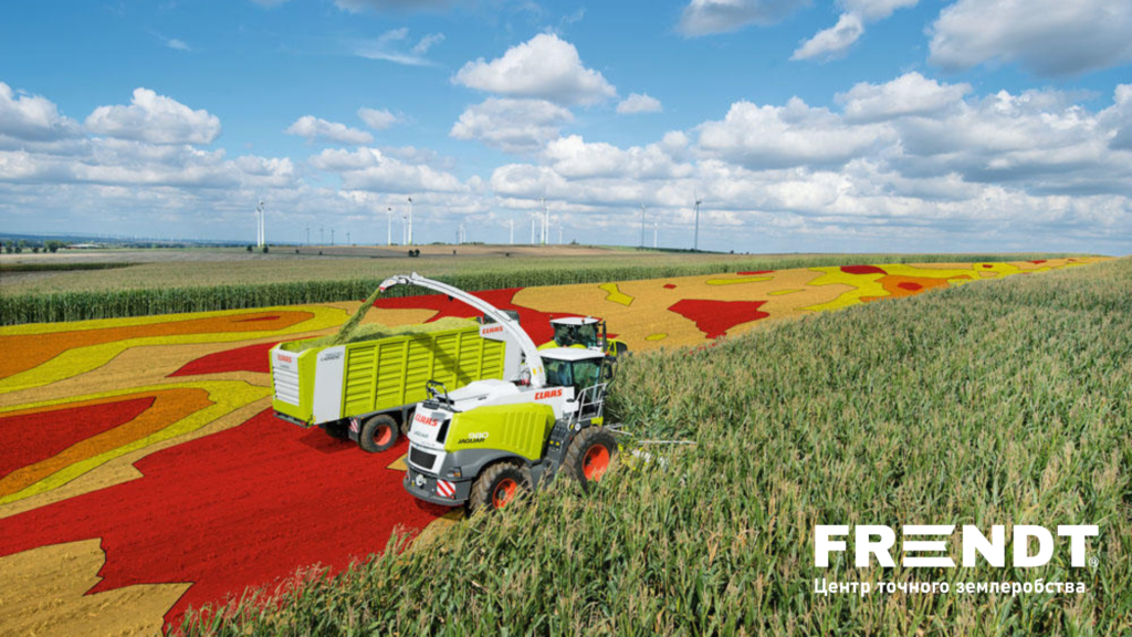
Harvest as a Source of Analytics: The Role of the FarmTRX System
FarmTRX is a retrofit yield monitoring solution designed to equip combines with yield mapping capabilities. One of its key advantages is versatility: according to the manufacturer, the system can be installed on virtually any combine equipped with a clean grain elevator and a 12V power supply.
During harvest, the system records grain flow, moisture content, and combine movement coordinates. Operators can monitor current and average yield as well as grain moisture directly from a smartphone or tablet. Once the data is uploaded to the FarmTRX Web App, the system automatically cleans and corrects the dataset, generating maps suitable for agronomic analysis.
A separate component of the system is the moisture sensor. According to FarmTRX, it is installed in the lower section of the clean grain elevator and transmits real-time grain moisture data to the mobile application during operation.
For a farm, this means that the combine becomes more than just a harvesting machine — it turns into a source of field productivity data.
Why Moisture Matters for Accurate Yield Evaluation
Yield data without moisture correction can distort the real picture. Two field zones may produce the same grain mass, yet the actual result may differ significantly if grain moisture levels are different. That is why moisture data is important not only for storage and logistics, but also for accurate field analysis.
When a system simultaneously records both yield and moisture, agronomists gain a far more precise understanding of field performance. This helps distinguish truly productive areas from zones where high yield readings may be partially influenced by elevated grain moisture.
In practical farm management, this is important for evaluating hybrids, maturity timing, terrain impact, soil variability, and zones with different water availability conditions.
Yield History: How Accumulated Data Changes Field Management
A yield map from a single season only reflects how a field performed under that year’s specific conditions. However, one season may not be representative: drought, excessive rainfall, a cold spring, crop stress during critical growth stages, or local operational mistakes can significantly influence the outcome.
That is why the greatest value comes not from individual maps, but from multi-season yield history.
If a specific zone consistently demonstrates lower productivity across different years and crops, it signals the presence of a systematic limiting factor. This may include soil acidity, compaction, moisture-related issues, terrain characteristics, salinity, erosion, lighter soil texture, or other underlying causes.
Conversely, consistently productive zones may become the basis for a more intensive management strategy: higher fertilizer rates, adjusted seeding density, or more precise yield potential management.
Yield maps are among the most valuable sources of spatial data in precision agriculture. However, meaningful conclusions require long-term datasets to avoid making management decisions based solely on weather conditions or isolated seasonal factors.
In other words, the true power of yield mapping is revealed not during harvest itself, but through the accumulation of historical data.
What Yield Maps Can Show an Agronomist
A yield map does not always explain the cause of a problem immediately. However, it can identify very precisely where that cause should be investigated.
If a low-yield zone coincides with a depression in terrain, the issue may involve excess moisture or soil compaction. If weak performance repeatedly occurs on slopes, erosion and water retention should be evaluated. If low productivity consistently overlaps with areas of low pH or nutrient deficiency, the map becomes a strong argument for variable-rate application. If productivity changes sharply along tillage boundaries, it may indicate overlaps, skips, machinery performance issues, or inconsistent field operations.
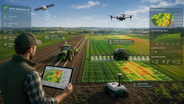
That is why yield maps should never be analyzed in isolation. They should be compared with other layers of data, including:
- soil analysis results;
- electrical conductivity maps;
- terrain data;
- satellite imagery indices;
- seeding maps;
- fertilizer application maps;
- tillage history;
- weather data;
- actual machinery tracks.
A yield map is not the answer to every question — it is a highly accurate indicator of where the right questions should be asked.
FarmTRX and Multiple Combines Operating in the Same Field
For large farms, another important challenge is generating a unified map when several combines operate in the same field. Under such conditions, datasets may differ due to variations in machinery, operators, calibration, header width, or harvesting practices.
FarmTRX describes the ability to create synchronized maps from multiple combines, even when machines differ in brand, model, and production year. After data synchronization within the Web App, the system processes differences between machines, cleans the datasets, and generates unified field maps for analysis.
This is particularly relevant for Ukrainian farms, where mixed fleets are common during harvest. Without bringing data from different combines into a unified framework, the resulting map may reflect machine inconsistencies rather than actual field productivity. In that case, agronomists risk analyzing data collection errors instead of the field itself.
Calibration: A Critical Step That Cannot Be Ignored
Yield mapping depends on one critically important condition — the data must be accurate. If the system is improperly calibrated, the map may look convincing while leading to incorrect management decisions.
Proper calibration is essential when yield data is used for management decisions, prescription maps, or profitability analysis. An uncalibrated monitor may provide relative information, but it is not reliable enough for precise operational decisions.
FarmTRX also includes calibration procedures within the mobile application based on grain volume or weight, and the manufacturer recommends calibrating once per crop each season.
That is why yield mapping should not be viewed as “install a sensor and get the truth.” It is a technology that requires proper implementation and operation. The more accurately installation, setup, calibration, and data cleaning are performed, the more valuable the resulting map becomes for the agronomist.