Accurate Field Boundaries: The Foundation of an Efficient Modern Farm
In today’s agribusiness, field boundaries are no longer just lines on a map or a technical formality. A field’s contour is the fundamental element of a farm’s management system, influencing nearly everything: fertilizer rates, machine performance, land-bank accounting, prescription maps, yield analysis, and long-term strategic planning.
An error of even one hectare is already a financial loss. For a large farm, a discrepancy of 5-10 hectares can result in systemic losses repeating year after year. Every extra bag of fertilizer, every additional machine pass, every liter of fuel wasted due to overlaps is a direct consequence of inaccurate field boundaries.

The more accurate the contour, the more accurate the following become:
• resource planning;
• field operations;
• prescription mapping;
• agri-analytics and reporting;
• cost calculations and profitability assessments for every field.
Within the 7 Levels of Precision Farming, field boundaries are the foundational component of Level 1. If they are inaccurate, all subsequent layers – analysis, navigation, variable-rate application, analytics – operate with a built-in systematic error
Losses Caused by Incorrect Field Boundaries
Boundary errors are one of the most underestimated sources of losses in agriculture. Farmers often do not realize the problem exists until they compare older contours with RTK measurements or data from modern navigation systems.
The most common and impactful losses include:
Overapplication of seed, fertilizers, and crop protection products
When the area is overestimated, the farm purchases and applies more inputs than needed. When underestimated, machinery creates overlaps and repeated passes. Losses may reach ₴300-₴1500 per hectare on fertilizers alone.
Inaccurate yield analytics and planning
The contour determines the correctness of all maps, including yield maps. If the area is larger than reality, yields appear lower; if smaller, analytics show unrealistically high values. Planning based on such data leads to poor agronomic decisions for the next season.
Overlaps and skips during machine operation
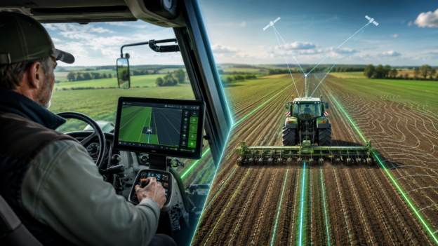
A navigator follows the contour. If the contour is wrong, the machine’s route will be incorrect as well. This increases fuel consumption, machine hours, lowers productivity, and produces the familiar effect of “shifted lines”.
Legal risks and land-bank accounting errors
Encroachment on neighboring parcels, mistakes in leased-area calculations, and incorrect documentation can trigger audits, disputes, and financial penalties.
Why Field Boundaries Are Often Inaccurate: Root Causes
Errors usually arise not because of “bad equipment,” but due to historical and technological limitations farms have faced for years. The most common scenarios include:
Contours created manually from satellite imagery “by eye”
Such files often have errors of tens of meters, especially on large tracts. This is one of the most widespread issues: the picture looks neat but lacks RTK-level accuracy, causing boundaries to “float.”
Outdated geometry reused for years without updates
Farms evolve – new roads appear, shelterbelts expand, machinery forms a different edge of the field – yet boundaries remain unchanged.
File-format inconsistencies and conversion distortions
Export/import between different displays or software can distort geometry, alter shapes, or change the area.
7 Signs Your Field Boundaries Are Inaccurate
You can detect the problem by observing machine behavior and comparing data from different sources. Warning signs include:
- the navigator shows the tractor “crossing the boundary” even when the operator follows the true field edge;
- prescription maps contain distortions or broken angles;
- the field area does not match cadastral documents;
- the same contour shows different values in different programs;
- actual seed or fertilizer needs are consistently higher/lower than planned;
- overlaps or repeated passes are visually noticeable during application;
- the contour has irregular, “broken” shapes, rounding artifacts, steps, or sudden jumps.
If you notice at least 2-3 of these indicators, your boundaries should be checked and updated.
How to Verify Field Boundaries Correctly: A Step-by-Step Methodology
The most reliable path to accurate boundaries combines high-precision measurement, professional data processing, and cross-checking with official information.
1. RTK field survey – the “gold standard” of accuracy
A tractor, ATV, or pickup equipped with an RTK receiver drives around the field perimeter. Modern RTK systems (including the FRENDT network) provide up to 2.5 cm accuracy, the industry standard for precision agriculture.
Advantages of RTK surveys:
- centimeter-level accuracy;
- objective coordinate anchoring;
- ability to periodically monitor and update contours.
2. Verification against cadastral data
Legal boundaries should closely match physical boundaries. Comparing RTK data with cadastral records helps detect overlaps, leased-area discrepancies, and other risk factors.
However, cadastral data may contain its own errors, so it must be treated as one reference source, not the ultimate truth.
3. Validation in professional software
Specialized software like Ag Leader SMS allows you to:
- check file geometry;
- detect and correct distortions;
- standardize contour shape;
- prepare it for use with prescription mapping and analytics.
How to Correct Field Boundaries: A Professional Workflow
Proper field-boundary adjustment is not a single action but a well-structured sequence of steps.
Step 1. Data collection: perform an RTK survey.
Step 2. Software processing: remove distortions, verify actual area.
Step 3. Export to required formats: shp, ISOXML, AgData, KML, etc.
Step 4. Update all equipment and farm software: synchronizing new boundaries across displays, prescription maps, yield-mapping systems, and digital platforms (FarmRTK, FlyAgData, etc.).
Step 5. Field test: the machine drives 50–100 meters along the edge, and the operator verifies alignment between the actual path and the contour displayed. If aligned, the boundary is validated.
Which FRENDT Solutions Provide the Highest Boundary Accuracy
FRENDT offers a comprehensive toolkit enabling Ukrainian farms to work with field boundaries at a global level of precision.
FRENDT RTK Network
- over 210 base stations;
- ~85% coverage of Ukraine;
- stable accuracy up to 2.5 cm;
- reliable positioning for field surveys and machinery operation.
FlyAgData
A digital analytics platform for data collection, equipment monitoring, and field-geometry management. It allows users to analyze boundaries, passes, yield maps, and make informed management decisions in a single environment.
Ag Leader SMS Software
A powerful solution for:
- creating and correcting field boundaries;
- generating yield maps;
- building variable-rate prescription maps;
- multi-year analytics and cross-season comparisons.
Together, these tools give farms not just “pretty maps,” but a controlled, precise, transparent field-management system.
Correct boundaries mean:
• 5-15% fewer overlaps;
• 3-25% lower excess fertilizer and CPP costs;
• tens of thousands of hryvnias saved annually for medium and large farms;
• accurate yield maps;
• high-quality prescription maps;
• correct analytics;
• transparent land-bank accounting.
Any path toward digitalization, automation, and a full precision-farming system begins with one simple but fundamental step: reliable, accurate field boundaries.
When boundaries are correct, everything else works correctly. When they aren’t, every subsequent decision multiplies the error.
That is why updating field boundaries is not an expense but an investment that starts paying off the moment machinery enters the field with accurate data.